BRIDGETON was a division of Nockamixon Township and became a township in 1890. Named for the arch and truss wooden bridge over the river between Upper Black Eddy, PA., and Milford, NJ - the last one to remain intact.2
Nockamixon, the
township, may be described as lying in northeastern Bucks County,
touching Delaware River at the Narrows, bounded northwest by
Springfield and Durham Townships, southeast by Tinicum Township,,
southwest by Haycock Township. Haycock Run and Tohickon
Creek form the southwest boundary line.
When Bridgeton
Township was raised in 1890, Nockamixon lost a third of its
territory.
|
|
Keep in mind that Bridgeton was formed out of
Nockamixon in 1890 so any research prior to 1890 would be
found under Nockamixon Township.
|
|
|
 | WILD CAT HOLLOW |
| FALLS CREEK RAVINE |
|
| | |
|
| Some Bridgeton
Residents 1891 Illustrated Atlas, 1891
|
| Brice Pursell
|
| Orville Goddard
|
| Barnet Lear
|
| Ed Goddard
|
| W. Goddard
|
| T. Fitzgerald
|
| Sarah Sigafoos
|
| Saml Raisner
|
| Harry Miller
|
| A. Miller
|
| J.W. Goddard
|
| Eli Hillpot
|
| Jacob Groover
|
| C. Minder
|
| J. Magowan
|
| Eli Miller
|
| Geo. M. Pickering
|
| J. Riegle
|
| J. Blanchard
|
| Aaron Kohl
|
| N. Kohl
|
| Joe Miller
|
|
| B. Suddler
|
| Danl Pursell
|
| David Pursell
|
| David Schliter
|
| Aaron Warwick
|
| Aaron Overpeck
|
| Charles Pickering
|
| Aaron S. Wismer
|
| John Nice
|
| John Fisher
|
| J. S. Sigafoos
|
| W.W. Haring
|
| Jerry Kohl
|
| M. McEntee
|
| Hugh Rymond
|
| Peter B. Agnew
|
| John Baiter
|
| Abraham Diehl
|
| John Sengly
|
| Dr. F. Cawley |
| Sigafoos
|
| R.F. Meyers
|
|
|
|
|
A case of small pox was reported in Williams
Township and the victim was sent to the Northampton
County Poorhouse for treatment. William Witman
of Nockamixon, PA, the captain of a boat who arrived
at Uhler's lime kiln from Frenchtown, reported
feeling ill. A doctor later diagnosed him with
small pox.
This is his Find A Grave biography:
|
|
|
Purcell Burial Ground
|
|
Trap Rock
FINGAL'S CAVE,
ISLAND OF STAFFA, SCOTLAND. Fingal's Cave on the
southwestern coast of the Islet of Staffa, Argyleshire,
Scotland, seven miles off the west coast of Mull, and
other caves in that isle, contain basaltic rocks of
similar trap rock formation.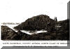
SPECIFIC
GRAVITIES AND CHEMICAL ANALYSES. The specific gravities
of the trap rocks from the four Pennsylvania fields
which I sampled are as follows: Bridgeton, 3.15;
Stony Point, 3.05; Pottstown, 3.23; Devil's Den, 3.06.
The sampling from the Bridgeton field for chemical
analysis, reported below, was made up of many small
pieces chipped from only rocks which had the best
ringing properties. All my samples were analyzed in the
laboratory of the Thomas Iron Company, by Mr. Walter
Wyckoff, chief chemist. Some of the
specific gravities and analyses of trap rocks reported
in the New Jersey Geological Survey, particularly for
the year 1907, are somewhat similar to those of my
samples, but as a rule the specific gravities are less
in the New Jersey reports. No test has come to my
notice of trap rock as heavy as the Pottstown samples,
which (by calculation) weigh 202 pounds to the '220
|
The Ringing Rocks. BY B. F.
FACKENTHAL,, JR., RIEGELSVILLE, PA.
The ringing
rocks of Bridgeton township (formerly part of
Nockamixon township) in Bucks county, Pa., are situated
about I%/4 miles west from the Delaware river, about 7
miles by public road from Riegelsville, Pa., and about
3 miles from Milford, N. J. They have an elevation of
about 500 feet, and present a most interesting
geological study. The illustrations shown on the
opposite page are from photographs of the main part of
the field, which covers an area of about 4 acres, and
in which the musical rocks are found. The rocks vary
from about ioo pounds to many tons in weight; there
are, however, very few small rocks. They are piled on
top of each other to a great depth, but their surface,
which is comparatively level, is not elevated above the
immediately adjoining land. When struck with a piece of
-rock, or with a hammer or other metallic object, they
give out a peculiarly musical, bell-like sound, the
tones often varying according to their shape and
position. Some of the rocks are decidedly more musical
than others, while some have only a dull sound; the
tone of many resembles that of a blacksmith's anvil.
The musical properties are not destroyed by removing
them from their beds, or from their locality. The large field
referred to does not contain a particle of soil or
vegetation of any kind. There are also some smaller
fields of similar rocks nearby; in fact, the entire
neighborhood is covered with rocks of the same
geological formation. The region is rough and rocky,
and a considerable part of the surrounding land cannot
be cultivated. Some of the rocks are of huge
proportions; the exposed surfaces of many contain
interesting indentations, due to the fact that 'they
have been subject to the weathering or leaching
process. These rocks
are igneous eruptions, and are doubtless outcrops of
dykes, which came up through the Mesozoic red sandstone
or, as commonly called, "new red sandstone" or
"red-shale," and can be traced, in a southwestwardly
direction, from the Delaware river across Bucks county,
following the foot-hills of South mountain, into
Montgomery and Chester counties. On the
north-western slope of Haycock mountain (960 feet
elevation) in Haycock township Bucks county, there are
also several outcrops of these barren rocks, including
one field at an elevation of 620 feet, having an -area
of about 3 acres, which have ringing properties, and
have always been known as "Stony Garden," a wild lonely
spot in the woods, about :2 miles from Stony Point
tavern, on the Durham road in Springfield township.*
The tones of the rocks at Stony Garden are not as
musical * This tavern, established in I758, was
formerly called " Three tuns."
A COLLECTION OF PAPERS READ BEFORE THE BUCKS COUNTY
HISTORICAL SOCIETY
PUBLISHED FOR THE SOCIETY BY B. F.
FACKEMTWAL, JR. *
RIEGELSVILLE, PA;. 1909
VOLUME III.
EDITORIAL COMMITTEE
HON. HARMAN YERKES MRS. AGNES WILLIAMS PALMER
HENRY C. MERCER CLARENCE D. HOTCHKISS
WARREN S. ELY B. F. FACKENTEHAL, JR.
|
4 or 5 times they tried to split the township, early
attempts were along the diabase, Beaver Run through
Revere and Kintnersville
NOCKAMIXON was settled by the same class of people
as Tinicum. The names of Thatcher, Weaver,
Richards, Dickson, Wilson, Ramsey, and Blair
indicate English or Scotch nationality, and they
were familiar names among the early settlers. The
German element appeared before the revolution, with
what result in establishing itself need scarcely be
stated. Among the early families of the latter
class were those of Frankenfield, Buck, Kintner,
Stover, Trauger, Keyser, and Cruchler. Some of
these are no longer represented, thus indicating
that even a German community may experience
changes. The English were most active in moving for
township organization. This was a long time under
consideration. It was petitioned for in 1742, and
in the following year a survey was made, which is
thus described: "Beginning at a black oak on ye
bank of Delaware by a corner of Durham tract;
thence by said tract and land of Thomas Blair,
south seventy degrees, west one thousand and forty
perches; thence by land of William Ware, southeast
two hundred and forty perches; thence southwest
five hundred and forty perches to Haycock run;
thence down said run to Tohickon creek; thence down
the said creek to a tract of land laid out to James
Sterling; thence by that and the London Company's
land northeast two thousand, one hundred and forty
perches to the river Delaware; thence up the same
to place of beginning." At March term, 1744, a
report embodying this was presented to court, but
for some reason it was not confirmed until 1746. It
is a large township, the area being about seventeen
thousand acres. The population in 1880 was one
thousand five hundred and fifty-four. For
convenience in voting it is divided into two
election districts, of which the one of most recent
origin is known as Bridgeton district. The
village of that name is the largest in the
township. It is situated on the Delaware, opposite
Milford, with which communication is established by
a bridge. The post-office is known as Upper Black's
Eddy. Some distance farther north, a hamlet in the
rear of the river hills bears the appropriate name
of Narrowsville. Kintnersville, so named from Major
Jacob Kintner, sheriff of the county in 1825, is
situated north of Gallows run. Several miles
farther inland and within the valley of that stream
is Rum corner, the seat of Nockamixon post-office.
Bucksville, founded by Nicholas Buck, is located on
the Durham road, and was a stopping-place for
stages half a century ago. There is little in its
present appearance to suggest the activity and
importance once derived from this source. (Battle's
History of Bucks County)
Papers Read before the Bucks County historical
Society -
page 143 Part 026-137
Mr.
Beatty was a trustee of the College of New Jersey at
Princeton, elected in
I763.
The institution was in its childhood and needed
larger resources than this country, just emerging
from the wars with the French and the Indians, could
furnish. It was deemed important that aid should be
solicited in the West Indies, some portions ,of which
were occupied by British planters, men of wealth. Dr.
John Witherspoon, the president who was first
requested to undertake the duty, being unable to
leave his post, Mr. Beatty was appointed to serve on
what proved to him a fatal mission. He arrived at the
Island of Barbadoes June 6th and died August i3,
I772,
stricken
with the yellow fever. There in the cemetery at
Bridgeton his remains are interred. As a public
speaker he was ready, fluent, impressive, and seldom
made use of a manuscript. Gentlemanly in his manners,
pleasing in his personal appearance and address, he
commanded respect and made friends wherever he went.
He was useful, active and influential in his parish,
in society, in the judicatories of the. church and in
the affairs of the country. School
Houses 8. MINE SPRING, in Bridgeton Township, near
Rupletown. Our fellow member, J. H. Fitzgerald, who
attended school there, says it was a school fifty
years ago. It appears on Scott's Atlas of 1876.
Page 304 Papers Read before BCHS 094-279 Page 147
120-133
Delaware
MILFORD, N. J., FERRY-From Upper Blacks Eddy, Bucks
County, Pa., to Milford, Hunterdon County, N. J.
Upper
Blacks Eddy is now in Bridgeton Township, erected in
1890 out of part of Nockamixon Township, Bucks
County. There is no reliable data at hand to show
when this ferry was established. A ford was used for
crossing before the ferry was built. The settlement
on the Pennsylvania side, called Upper Blacks Eddy,
was a most desirable place for raftmen to tie up for
the night. This is the longest eddy on the river, and
was usually crowded with rafts during the spring
flood rafting season. A post office was established
there in 1830. The earliest record at hand of the New
Jersey side is a copy of a survey, about 1757, by
Elisha Emley, which indicates a sawmill on the
Wissahawken Creek, about 200 feet from its mouth at
the Delaware. Later a gristmill was built farther up
the creek, which, in 1769, when the property of Col.
John Reid, was destroyed by fire. This gave the
settlement the name of Burnt Mills. In 1798 Col.
Thomas Lowrey bought 333 acres of land in and around
what is now the town of Milford, including the 147
148
IMPROVING NAVIGATION ON THE DELAWARE RIVER site
of the burnt mill, and during the following years
1799-1800, erected a gristmill by the riverside, to which shortly thereafter he added a sawmill.
The place was then called Lowreytown, and the ferry
Lowreytown Ferry. In 1803 the name was permanently
changed to Milford, and the ferry to Milford Ferry.
There is a tradition that, although the ferry was
established prior to 1803, the town was named for the
ferry, a combination of the words Mill and Ford. When
the river bridge w as opened for travel in 1842, the
ferry was shut down. (For Milford bridge, see page
175.) (History of Hunterdon County, pp. 427, 429, and
History of the Lowrey Family in The Jerseyman, pp. 21
to 26.)
|
Mary A Black
Isaac ?Black
Henry R Black
Confirmation: 26 Mar 1880
Upper Black Eddy, Bucks, Pennsylvania
Upper Tinicum Lutheran Church
|
|